


Offa's Dyke Path
Offa's Dyke Path
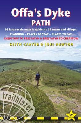
The Offa's Dyke Path is a magnificent National Trail that runs from the North Wales coast to the Severn Estuary following the line of Offa's Dyke, an impressive 8th century earthwork along the English/Welsh border. The ever-changing landscape - the Wye Valley, the Black Mountains, the Shropshire Hills and the Clwydian Hills - is steeped in history and legend providing 177 miles of fascinating walking. This is the 5th edition. * 98 walking maps - 1:20,000 (3-1/8 inches to 1 mile) - the largest-scale maps available. *Unique mapping features - walking times, directions, tricky junctions, places to stay, places to eat, points of interest. * Itineraries for all walkers - whether walking the route in its entirety or sampling the highlights on day walks and short breaks. * Practical information for all budgets - what to see, where to stay, where to eat: pubs, B&Bs, hotels, campsites, hostels. * Guides to 52 towns and villages - along the way * Public transport information - all access points on the path. * GPS waypoints. These are also downloadable from the Trailblazer website. * Includes extra colour sections: 16pp color introduction and 16pp of colour mapping for stage sections (one stage per page) with trail profiles.
PRP: 88.26 Lei
Acesta este Pretul Recomandat de Producator. Pretul de vanzare al produsului este afisat mai jos.
79.43Lei
79.43Lei
88.26 LeiPrimesti 79 puncte

Livrare in 2-4 saptamani
Descrierea produsului
The Offa's Dyke Path is a magnificent National Trail that runs from the North Wales coast to the Severn Estuary following the line of Offa's Dyke, an impressive 8th century earthwork along the English/Welsh border. The ever-changing landscape - the Wye Valley, the Black Mountains, the Shropshire Hills and the Clwydian Hills - is steeped in history and legend providing 177 miles of fascinating walking. This is the 5th edition. * 98 walking maps - 1:20,000 (3-1/8 inches to 1 mile) - the largest-scale maps available. *Unique mapping features - walking times, directions, tricky junctions, places to stay, places to eat, points of interest. * Itineraries for all walkers - whether walking the route in its entirety or sampling the highlights on day walks and short breaks. * Practical information for all budgets - what to see, where to stay, where to eat: pubs, B&Bs, hotels, campsites, hostels. * Guides to 52 towns and villages - along the way * Public transport information - all access points on the path. * GPS waypoints. These are also downloadable from the Trailblazer website. * Includes extra colour sections: 16pp color introduction and 16pp of colour mapping for stage sections (one stage per page) with trail profiles.
Detaliile produsului
De pe acelasi raft
-

PRP: 123.69 Lei
111.32 Lei
111.32 Lei123.69 Lei
-
PRP: 123.69 Lei
111.32 Lei
111.32 Lei123.69 Lei
-
PRP: 123.69 Lei
111.32 Lei
111.32 Lei123.69 Lei
-
PRP: 129.89 Lei
116.90 Lei
116.90 Lei129.89 Lei
-
PRP: 202.17 Lei
181.95 Lei
181.95 Lei202.17 Lei
-
PRP: 87.99 Lei
79.19 Lei
79.19 Lei87.99 Lei
-
PRP: 88.26 Lei
79.43 Lei
79.43 Lei88.26 Lei
-
PRP: 87.99 Lei
79.19 Lei
79.19 Lei87.99 Lei
-
PRP: 260.09 Lei
234.08 Lei
234.08 Lei260.09 Lei
-
PRP: 167.09 Lei
150.38 Lei
150.38 Lei167.09 Lei
