


Map of UK and Ireland
Map of UK and Ireland
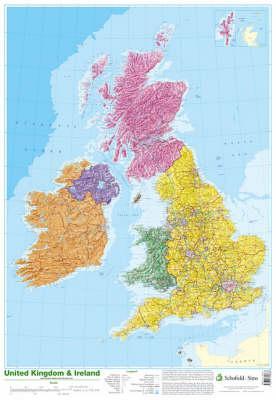
This detailed relief map of the United Kingdom and Ireland is colour coded to show the area of each country and large city. County boundaries are marked, as are rivers, motorways, ports and airports. An explanation of the political relationship between the countries is given, alongside information about the distance from sea level to Ben Nevis.
Descrierea produsului
This detailed relief map of the United Kingdom and Ireland is colour coded to show the area of each country and large city. County boundaries are marked, as are rivers, motorways, ports and airports. An explanation of the political relationship between the countries is given, alongside information about the distance from sea level to Ben Nevis.
Detaliile produsului


