


Hadrian's Wall Path Map Booklet
Hadrian's Wall Path Map Booklet
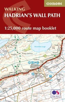
All the mapping you need to complete the 84 mile (135km) Hadrian's Wall Path from Bowness-on-Solway in Cumbria to Wallsend, Newcastle. One of the UK's most visited national trails, it typically takes a week to walk, and is suitable for walkers and trekkers at all levels of experience.
This booklet of Ordnance Survey 1:25,000 Explorer maps has been designed for convenient use on the trail. It shows the full and up-to-date line of the Hadrian's Wall Path, along with the relevant extract from the OS Explorer map legend. It can be used when walking the trail west-east or east-west, and includes an extension to the east coast at South Shields. It is conveniently sized for slipping into a jacket pocket or top of a rucksack and comes in a clear PVC sleeve.
This booklet is included with the Cicerone guidebook to Hadrian's Wall Path National Trail.
Begun in AD122 and stretching from the River Tyne to the Solway Firth, Hadrian's Wall is the best preserved frontier from the classical Roman Empire. Today it is a World Heritage Site, with iconic scenery and fascinating archaeological remains.
Descrierea produsului
All the mapping you need to complete the 84 mile (135km) Hadrian's Wall Path from Bowness-on-Solway in Cumbria to Wallsend, Newcastle. One of the UK's most visited national trails, it typically takes a week to walk, and is suitable for walkers and trekkers at all levels of experience.
This booklet of Ordnance Survey 1:25,000 Explorer maps has been designed for convenient use on the trail. It shows the full and up-to-date line of the Hadrian's Wall Path, along with the relevant extract from the OS Explorer map legend. It can be used when walking the trail west-east or east-west, and includes an extension to the east coast at South Shields. It is conveniently sized for slipping into a jacket pocket or top of a rucksack and comes in a clear PVC sleeve.
This booklet is included with the Cicerone guidebook to Hadrian's Wall Path National Trail.
Begun in AD122 and stretching from the River Tyne to the Solway Firth, Hadrian's Wall is the best preserved frontier from the classical Roman Empire. Today it is a World Heritage Site, with iconic scenery and fascinating archaeological remains.
This booklet of Ordnance Survey 1:25,000 Explorer maps has been designed for convenient use on the trail. It shows the full and up-to-date line of the Hadrian's Wall Path, along with the relevant extract from the OS Explorer map legend. It can be used when walking the trail west-east or east-west, and includes an extension to the east coast at South Shields. It is conveniently sized for slipping into a jacket pocket or top of a rucksack and comes in a clear PVC sleeve.
This booklet is included with the Cicerone guidebook to Hadrian's Wall Path National Trail.
Begun in AD122 and stretching from the River Tyne to the Solway Firth, Hadrian's Wall is the best preserved frontier from the classical Roman Empire. Today it is a World Heritage Site, with iconic scenery and fascinating archaeological remains.
Detaliile produsului
De acelasi autor
-

Price
115.26 Lei
115.26 Lei


