


West Highland Way Map Booklet

West Highland Way Map Booklet
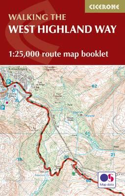
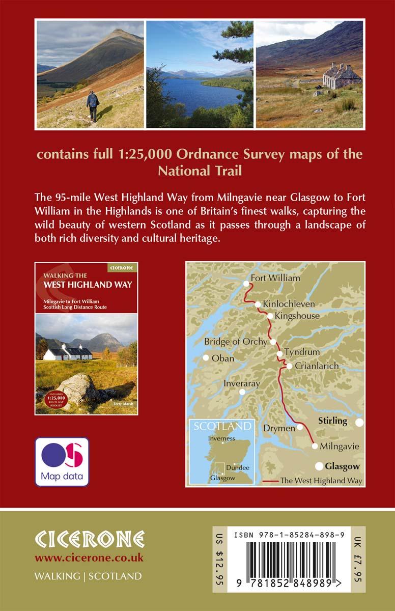
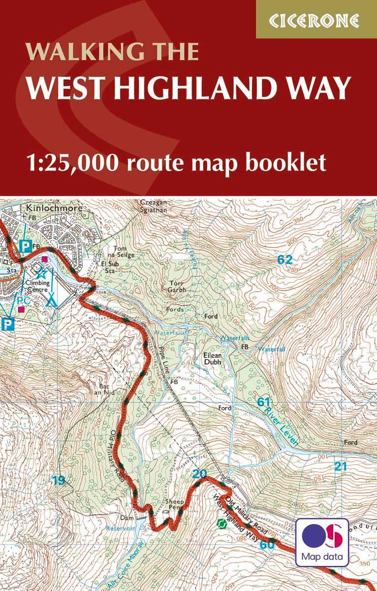
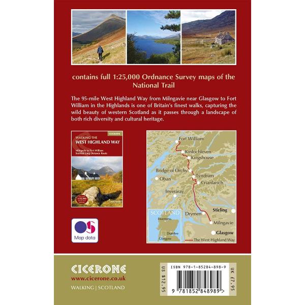
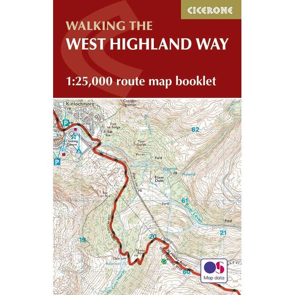
All the mapping you need to complete the 95 mile (153km) West Highland Way, an official Scottish Long Distance Route from Milngavie near Glasgow to Fort William. Showcasing the wild beauty of western Scotland, the trail is a journey from the lowlands to the highlands, passing Loch Lomond then crossing Rannoch Moor before finishing in the shadow of Britain's highest mountain, Ben Nevis. The walk takes roughly a week to complete and is presented in seven stages ranging from 8 to 20 miles.
This booklet of Ordnance Survey 1:25,000 Explorer maps has been designed for convenient use on the West Highland Way. It shows the full and up-to-date line of the route along with the relevant extract from the OS Explorer map legend, and can be used when walking the trail in either direction. Conveniently sized for slipping into a jacket pocket or the top of a rucksack, it comes in a clear PVC sleeve.
NOTE An accompanying Cicerone guidebook - The West Highland Way ISBN9781852848576 - describes the full route with lots of other practical, historical and cultural information. The guidebook INCLUDES a copy of this map booklet.
PRP: 67.59 Lei
Acesta este Pretul Recomandat de Producator. Pretul de vanzare al produsului este afisat mai jos.
60.83Lei
60.83Lei
67.59 LeiPrimesti 60 puncte

Livrare in 2-4 saptamani
Descrierea produsului
All the mapping you need to complete the 95 mile (153km) West Highland Way, an official Scottish Long Distance Route from Milngavie near Glasgow to Fort William. Showcasing the wild beauty of western Scotland, the trail is a journey from the lowlands to the highlands, passing Loch Lomond then crossing Rannoch Moor before finishing in the shadow of Britain's highest mountain, Ben Nevis. The walk takes roughly a week to complete and is presented in seven stages ranging from 8 to 20 miles.
This booklet of Ordnance Survey 1:25,000 Explorer maps has been designed for convenient use on the West Highland Way. It shows the full and up-to-date line of the route along with the relevant extract from the OS Explorer map legend, and can be used when walking the trail in either direction. Conveniently sized for slipping into a jacket pocket or the top of a rucksack, it comes in a clear PVC sleeve.
NOTE An accompanying Cicerone guidebook - The West Highland Way ISBN9781852848576 - describes the full route with lots of other practical, historical and cultural information. The guidebook INCLUDES a copy of this map booklet.
This booklet of Ordnance Survey 1:25,000 Explorer maps has been designed for convenient use on the West Highland Way. It shows the full and up-to-date line of the route along with the relevant extract from the OS Explorer map legend, and can be used when walking the trail in either direction. Conveniently sized for slipping into a jacket pocket or the top of a rucksack, it comes in a clear PVC sleeve.
NOTE An accompanying Cicerone guidebook - The West Highland Way ISBN9781852848576 - describes the full route with lots of other practical, historical and cultural information. The guidebook INCLUDES a copy of this map booklet.
Detaliile produsului
De pe acelasi raft
-

PRP: 87.99 Lei
79.19 Lei
79.19 Lei87.99 Lei
-
PRP: 87.99 Lei
79.19 Lei
79.19 Lei87.99 Lei
-
PRP: 67.59 Lei
60.83 Lei
60.83 Lei67.59 Lei
-
PRP: 101.59 Lei
91.43 Lei
91.43 Lei101.59 Lei
-
PRP: 154.69 Lei
139.22 Lei
139.22 Lei154.69 Lei
-
PRP: 185.93 Lei
167.34 Lei
167.34 Lei185.93 Lei
-
PRP: 164.92 Lei
148.43 Lei
148.43 Lei164.92 Lei
De acelasi autor
-
PRP: 128.86 Lei
115.97 Lei
115.97 Lei128.86 Lei
-
PRP: 81.19 Lei
73.07 Lei
73.07 Lei81.19 Lei
